Ingleby Moor and Greenhow Bank Walk
We’ve done this walk a fair few times now I think it’s based on a walk from a pathfinder guide we’ve had for years. It’s a brilliant walk no matter what the weather, It’s especially fun in the snow. There are also plenty of options for making the walk longer such as turning left at the bottom of Greenhow bank and goring through the fields past low farm, or walking up to Bloworth Crossing and doubling back on your self before going down Grenehow bank The first path is a bit of a strange one as it goes up someone’s drive then between a fence, it’s usually quite over grown and muddy so it’s easy to miss the sign at the bottom of their drive. Length: 10 miles Start/Finish: Car Park near the Church or school in...
Read MoreHutton-le-Hole, Bank Top and Lastingham Walk
With the cancellation of the Great Yorkshire Show we we’d both taken a day off so were at a bit of a loose end and decided to try a new walking route out up on the moors and then visit Yorkshire’s Favourite Pub 2012 The route is a shortened version of a 20mile walk I had planned for a day when we have more time, it can easily be extended to visit Rosedale, Appleton Le Moors and Cropton. There are also lots of options for paths once you hit Ana Cross some are boggier than others, we followed the wide sandy track due to all the rain we’ve been having lately. Length: Just over 10 miles Start/Finish: SE 706 903 (or the car park in Hutton-le-Hole at SE 705 901) Refreshments: Tea rooms and the excellent Crown Inn at Hutton-le-Hole, Cafe’s and...
Read MoreFarndale Daffodil Walk
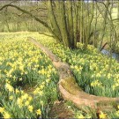
This is a short but stunning walk if you pick the right time of year, as there are literally thousands of daffodils covering the ground as far as the eye can see. It’s best not to go on a weekend as it’s usually packed with tourists but you really do need to go and give it a go sometime. It’s also not far from some excellent moorland haunts and coastal villages so you can always do it as part of a day out. If you want to make it a bit longer you can head past the Feversham arms up the bank to The Lion at Blakey Ridge or take one of the many paths that lead up and around the valley. Distance: 4 Miles Terrain: Woodland paths Best time of year: Spring so the daffodil’s are in full bloom. Refreshments: Daffy Cafe at High mill and Feversham arms...
Read MoreDanby, Fryup and Danby Castle Walk
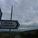
This is another one of those walks we tend to do when we are looking for a quick few miles to stretch our legs followed by a pub meal somewhere, in this case usually the Fox and Hounds at Ainthorpe. It’s a nice easy walk over fields and a little bit of road, there’s a couple of small up ascents but nothing too steep or difficult. There’s a couple of pubs along the route, a couple of cafe’s, a castle, 14th century bridge and even a place called Fryup (of moonpig fame) We usually start the walk from the car park near the Duke of Wellington and Stonehouse Bakery in Danby it’s self but if you don’t fancy walking along the road you can always park at the Danby Moors Centre, but this usually costs a few quid…although it goes to...
Read MoreTracklogs mapping software
This is a review I wrote a while back on a well known outdoors forum (and the pics are from the Tracklogs website), to be honest not much has changed apart from a slight increase in price (so i’ve changed those), I still love the software, all It needs now is an IPhone App. It’s another long one so best grab a cuppa or a pint if you are going to read it all. 1) Ordering. This couldnt be easier, log onto their website, select the maps you want from a huge selection, they do all the usual OS Maps and scales along with arial photography and something called site centred mapping which allows you to pay for an area around a particular postcode or location. I went for some of the Standard OS 1:25K maps that came in at £29.95 Each including delivery. I...
Read More
Follow Me!