Whitby to Redcar Walk

I seem to have a huge backlog of blogs for walks we have done over the past few months, including this one which originally started off as Redcar to Whitby as we have done it that way a couple of times, but as we walked it in the opposite direction yesterday I thought I’d post this one before my stuff from the Dales and Northumberland.
Traditionally this walk is done from Whitby Whalebones to the Frigate pub in Marske or to the Ship Inn in Saltburn, but to save getting a lift or taxi back to Redcar we usually just walk the extra couple of miles.
Much of this coastal path follows the Cleveland Way so it’s really simple to follow and there’s no difficult navigation to worry about.
The day started off rather grey and misty but the sun soon came out and stayed for the rest of the day making it an absolute scorcher.
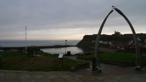
Basically you leave Whitby away from the Whalebones on the West cliff and keep the sea on your right hand side at all times. At the end of the cliff follow the path with the houses on your left, this brings you out near the golf course, drop down to the slipway then climb back up, watching out for stray golfballs, when you hit the road turn right and head towards Sandsend.
On reaching Sandsend cross over the bridge and follow the road along the seafront, until you get to the cafe and carpark at the far end of the village, go through the arched entrance to the carpark and head across to the steps that climb up the cliff. From here follow the Cleveland way along the cliff top until you reach Kettleness.
Skirt round the farm and keep following the path along before climbing down the path onto Runswick Bay Beach, be careful, it’s a little bit slippy as its basically a steam bed.
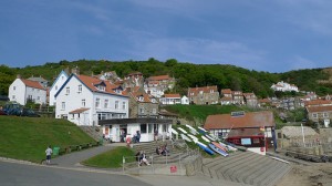
Once on the beach head for the the slipway at the far end of the beach, once you get onto the road you can either follow it up the steep bank or work your way through the houses. After the hotel and the car park turn right following the signposted footpath which heads back out onto the cliffs.
This path takes you through Port Mulgrave (which is a cracking fishing spot by the way) when you reach the road in Port Mulgrave, turn right along it until you reach a gate that then opens up into a cliff top path.
Next stop is Staithes, where we stopped at the cafe for a smoothie and a slice of their legendary cobble cake, which at the time seemed like a good idea but half way up cowbar bank we realised the cake probably wasn’t the best choice.
To get to cowbar you simply follow the road through Staithes, past the Cod and Lobster then turn right at the bistro, cross over the little bridge that leads to the life boat station and turn left up the big hill.
Once at the top follow the cliffs and begin the steady climb up to Boulby Cliff, again keeping the sea on your right and the mine on your left.
Once at the top go past the farm and the joinery yard, follow the Cleveland Way markers through the gorse bushes, gradually climbing up hill.
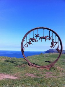
Follow the path along the cliffs with Hummersea scar rocks below you before reaching the fishing village of Skinningrove. Climb down the steps then head for the blue, white and red boat on the other side of the beach, pass this and go between the gap in the old breakwater. Follow the beach for a few hundred meters before climbing up the steep steps to the top of the bank. Follow the grassy path along the cliff tops once again, you will soon join a railway track on your left which you follow for a while, passing some art sculptures on your way before arriving at the top of Huntcliff.
Drop down the steps behind the Ship Inn, follow the road round to the base of Saltburn Pier. Now if you are heading to Redcar there are a few options, you can walk straight along the beach, climb back up on the cliffs or go through the woods. Either way you will end up in Marske and then it’s a quick walk along the grassy dunes to Redcar.
It really is a fantastic walk along some of the most under rated coastline in the country, when the sun is shining it’s even more stunning.
If you fancy giving it a go then you can download the gpx file here. you can also view my photos on flickr here.


Being looking at doing
for charity in 2013 came across your page whilst looking for a route we plan to do it in